Severe weather coming to our area Tuesday
Published 7:44 am Monday, March 21, 2022
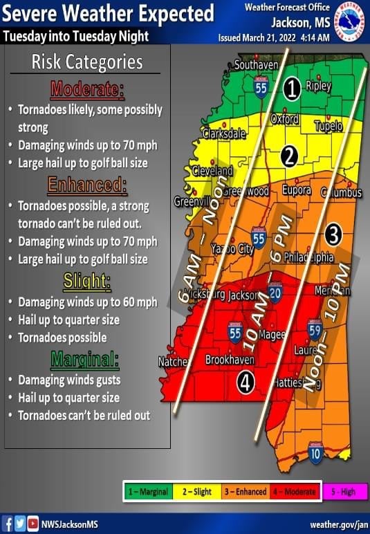
Severe weather will hit Jefferson Davis County Tuesday as the county has been put in the red zone which is the moderate risk category.
Heavy rainfall of three to six inches is expected which could lead to flooding of roads and some structures. Tornadoes are possible.
According to the NWS, models are showing two rounds of storms. The first would be in the afternoon hours, bringing the threat of supercells that could produce a few strong tornadoes. The second round will move though during the evening bringing the threat of damaging
winds and tornadoes. Damaging winds of up to 70 miles per hour are possible with up to golf ball size hail. The timing for our area is from 10 a.m. until 6 p.m.
The Mississippi Emergency Management Agency made the following suggestions ahead of the severe weather:
•Have a plan in place in case there is a tornado or flooding.
•Have a disaster kit ready.
•Monitor weather alerts for your area.
•Keep updated “before” photos of your home in case of a disaster.


