Severe weather headed into the area tonight and tomorrow
Published 3:46 pm Tuesday, April 12, 2022
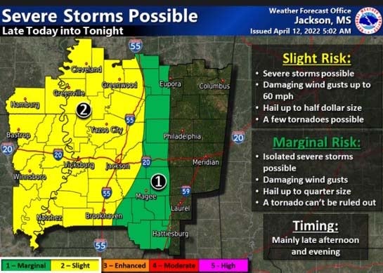
Severe weather remains possible late today into tonight, especially during the evening hours. Isolated severe storms with damaging wind gusts and hail up to a quarter in size are possible for Jefferson Davis County.
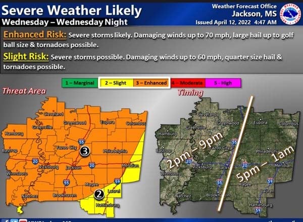
Severe weather is likely for most of the area Wednesday into Wednesday night, especially during the afternoon to evening ours. Damaging winds up to 70 miles per hour, large hail up to golf ball size and tornadoes remain possible in any severe storms. Jefferson Davis County is in the enhanced risk category. Timing for the county is from 5 p.m. until 1 a.m.
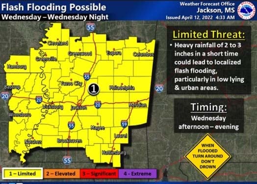
Flash flooding is also possible Wednesday. Heavy rain of two to three inches in a short duration is anticipated. Localized flooding, especially in low-lying and urban areas, remains possible.
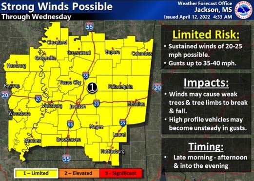
Gusty southerly winds will also be possible today through Wednesday. Sustained winds of 20-25 miles per hour with gusts of 35-40 miles per hour may cause weak trees and limbs to break and fall. Driving may be more difficult, especially for high profile vehicles.


